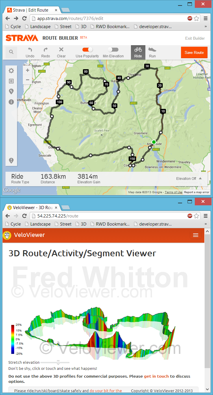
 Back in July I had my first experience with bookmarklets when playing with Marc Durdin’s excellent bit of code that provides his funky elevation profiles for Activities and Segments right there, in amongst Strava’s own page contents. I might have been a bit naive but I just didn’t realise that this thing was so easy to do, so time for a quick play and see what I could come up with. First off I wanted to get an interactive 3D view of the new Strava Routes, the other thing that sprung to mind was to see if I could swap out the Google Maps view for the more detailed (at least here in the UK) Open Street/Cycle Maps which I’ll go into in my next blog post.
Update: unfortunately this approach to getting data for the 3D viewer is remarkably unstable due to the ever changing code at each of the sites mentioned above. Currently I think all of the sites listed have changed their code sufficiently for my code to no longer work and I’m not going to attempt to maintain it. Instead I’ve added a GPX import option on the 3D routes page but it does rely on the GPX file including elevation data. The GPX export from Strava doesn’t so that won’t work so the best site I’ve found so far to create your GPX files is Ride With GPS. The elevation data isn’t the best though so don’t expect very good profiles (Garmin Connect appears to have the best elevation data right now but there is no GPX export!). Of course if you’ve ridden the route then just view your activity on VeloViewer and you’ll see a 3D view there.
Continue reading →